

Weather Highlights
More snow and severe weather on the way

Author: Matthew Holliday
Overview
As this week’s storm system progresses eastward, a longwave trough will develop across the eastern half of the nation by the weekend. At the same time, a ridge will build over the western third of the U.S. This pattern configuration will favor well below average temperatures along and east of the Plains through the weekend and toasty conditions west of the Plains. Severe weather chances will once again increase mid-week for parts of the South.
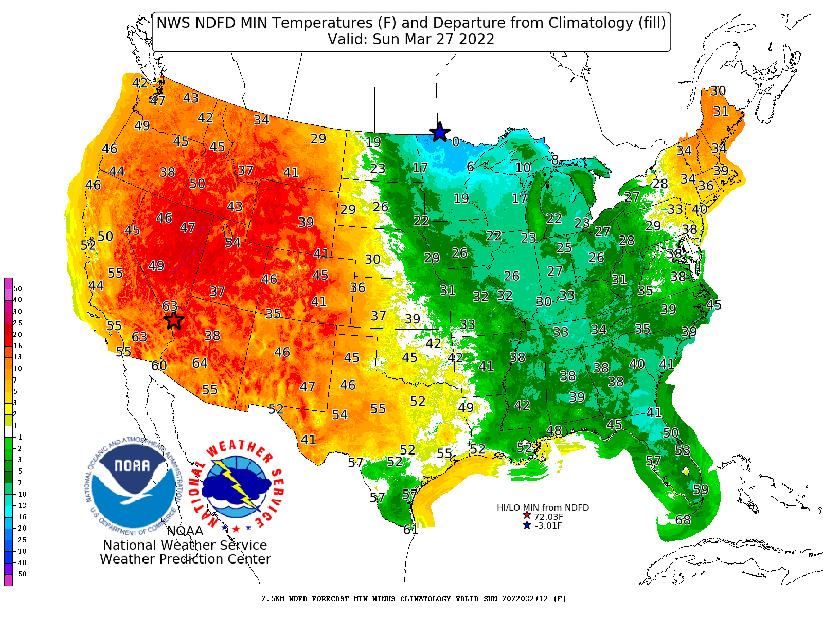
Figure 1: Projected low temperatures Sunday morning
Highlights
A vigorous storm system will bring snow accumulations across the Great Lakes and Ohio Valley regions over the weekend. Decent accumulations will also occur along and near the western/northwestward facing slopes of the Appalachian mountains.
Temperatures will begin trending upward from west to east early next week, as a longwave trough exits the eastern U.S. and is replaced by large-scale ridging.

Figure 2: Projected high temperatures on Monday
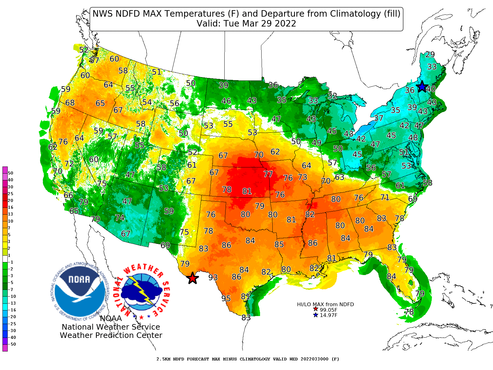
Figure 3: Projected high temperatures on Tuesday
A strong shortwave will enter California early in the week, finally bringing rain and high-elevation snow chances to the region and across the Southwest. The Rockies will also get a decent shot at snow accumulations between early and mid-week.
The California storm system will trek eastward, triggering the development of a low pressure system over the Plains. This feature will bring another round of severe weather across parts of the Plains and Southeast between mid and late week. Tornadoes, hail, straight-line winds, and flooding will all be possible.
