

Weather Highlights
The heat is on.

Forecast Discussion for this Week
A strong ridge will persist across the southwestern U.S. this week but begin moving eastward and expanding into the Southern Plains, Mid-South, and Southeast by mid-week. Before this occurs, a front will briefly bring humidity levels down across the upper half of the Mid-South and Southeast but will stall before reaching the Gulf coast. Fortunately, this front will also usher in a drier air mass into the Mid-Atlantic and New England, where atmospheric moisture levels have resembled those usually found in the deep tropics.
A shortwave will enter the upper-Midwest today and will carve out a broad trough early this week that’ll persist for several days. This trough will center over the Great Lakes region and extend down into the Ohio Valley. So while everyone else is roasting out West and across the South, the northern/central Great Plains, Midwest, Great Lakes region, Ohio Valley, and at times, inland New England will feel much more pleasant.
An incoming shortwave will enter Washington State from the Pacific early in the week, very briefly beating down the ridge across the Pacific Northwest and northern parts of the Inter-Mountain West on Tuesday. However, temperatures will quickly rebound to well-above average values by mid-week as the ridge re-amplifies.
The central Plains, mid-Mississippi Valley and Tennessee Valley will generally sit along the periphery of the ridge. These areas could have at least a couple storm complexes move through this week. Fluctuations in ridge strength will determine exact track of each storm cluster. The primary risk will be damaging, straight-line winds. It’s worth noting that these storms may stay organized long enough to reach north Georgia and the Carolinas.
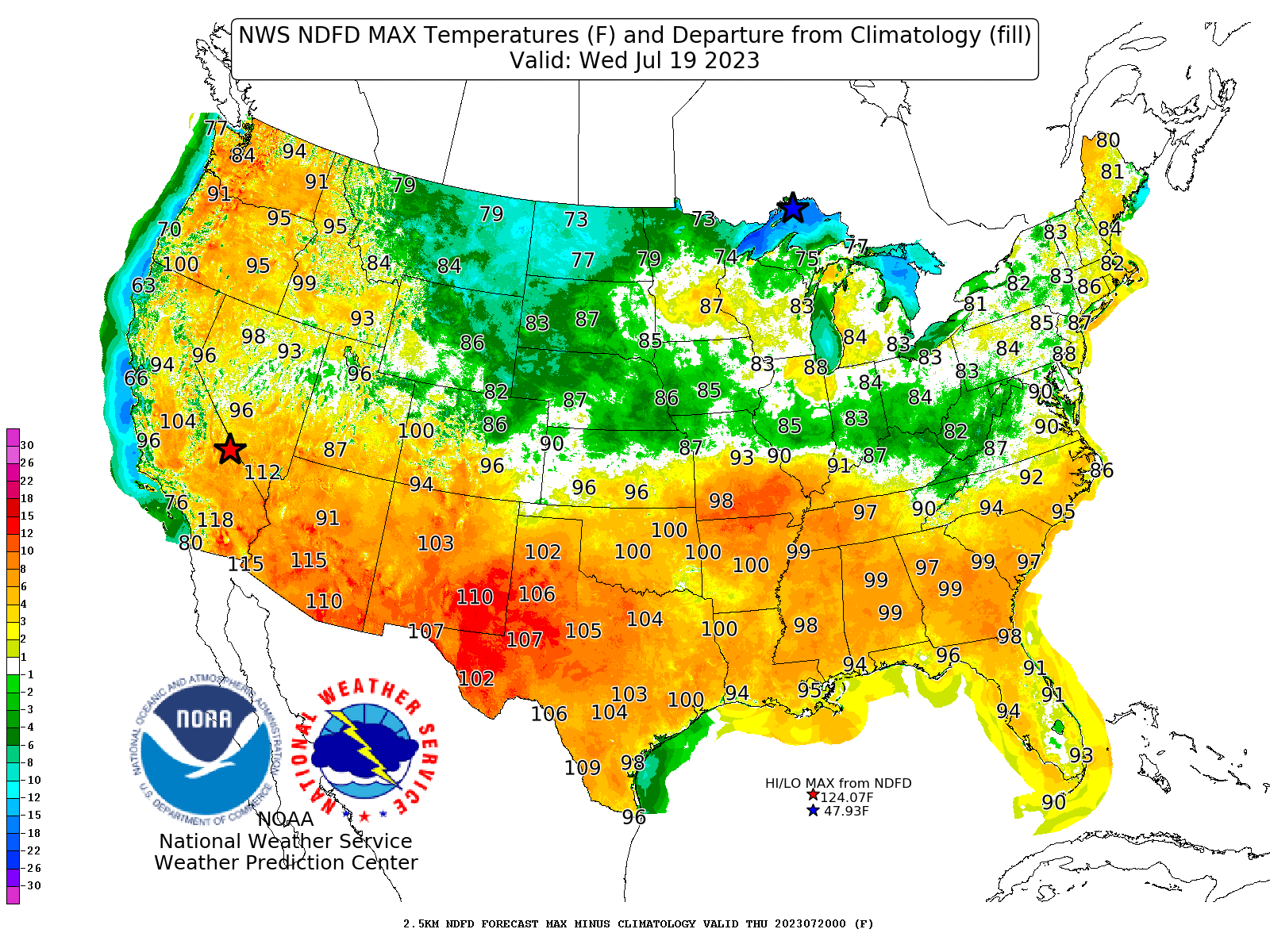
Projected high temperatures and departure from averages for Wednesday, July 19, 2023.
Thank you Matthew