

Weather Highlights
A couple of storm systems to watch this upcoming week

Author: Matthew Holliday
Overview
A potent low pressure system will depart the Rockies and exit the Northern Plains on Monday. A second low pressure system will develop across the lower Plains early week, thanks to the merging of several shortwaves. This storm system will bring a swath of beneficial rainfall, especially from parts of the southern Plains to the Corn Belt.
Highlights
A closed low off the NC coast will continue to transport deep moisture into New England and the coastal Mid-Atlantic early week. Rainy conditions will persist on and off Monday, along and northeast of New Jersey and eastern New York State.
The Southeast will experience above-average temperatures through mid-week ahead of an approaching cold front. Any pre-frontal rainfall across Georgia, the Carolinas, and Florida will come and go quickly. The heaviest rain will occur just west and northwest.
A parade of storm systems will move across the Pacific Northwest over the next 7-10 days, signaling a significant pattern change that’s already begun. Flash flooding will most certainly occur in western Oregon and Washington, especially posing issues at/near burn-scarred terrain.
The Ohio Valley and Great Lakes region will get rain in the late Tuesday to Wednesday timeframe from the second low-pressure area. A surface high pressure will build behind the system afterward, wrapping around seasonably cool air.
The overall pattern will favor below to well-below-average temperatures across the western third of the U.S. through at least the weekend. The rest of the U.S. will experience above-average temperatures early/mid week ahead of the approaching cold front. Temperatures will become more seasonable for at least a couple of days after the frontal passage.
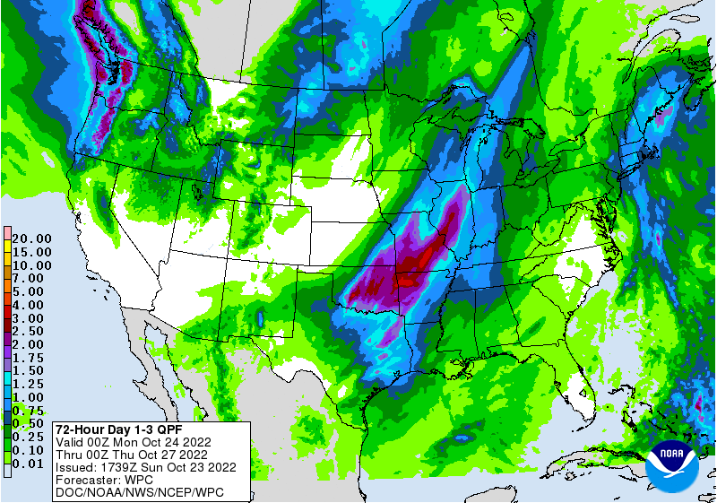
Projected rainfall totals Sunday evening through Wednesday evening (Oct. 23-26, 2022)
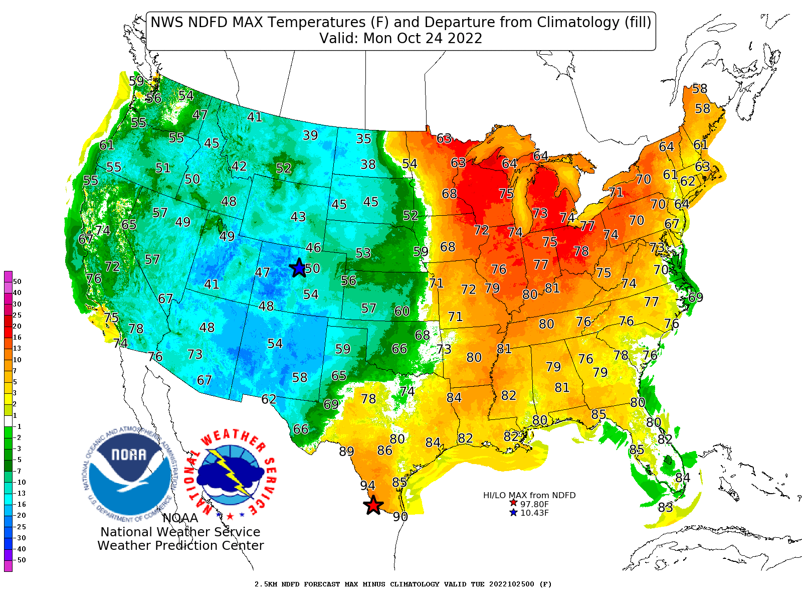
Projected high temperatures on Monday, Oct. 24, 2022. Red/blue shading indicates above/below average temperatures.
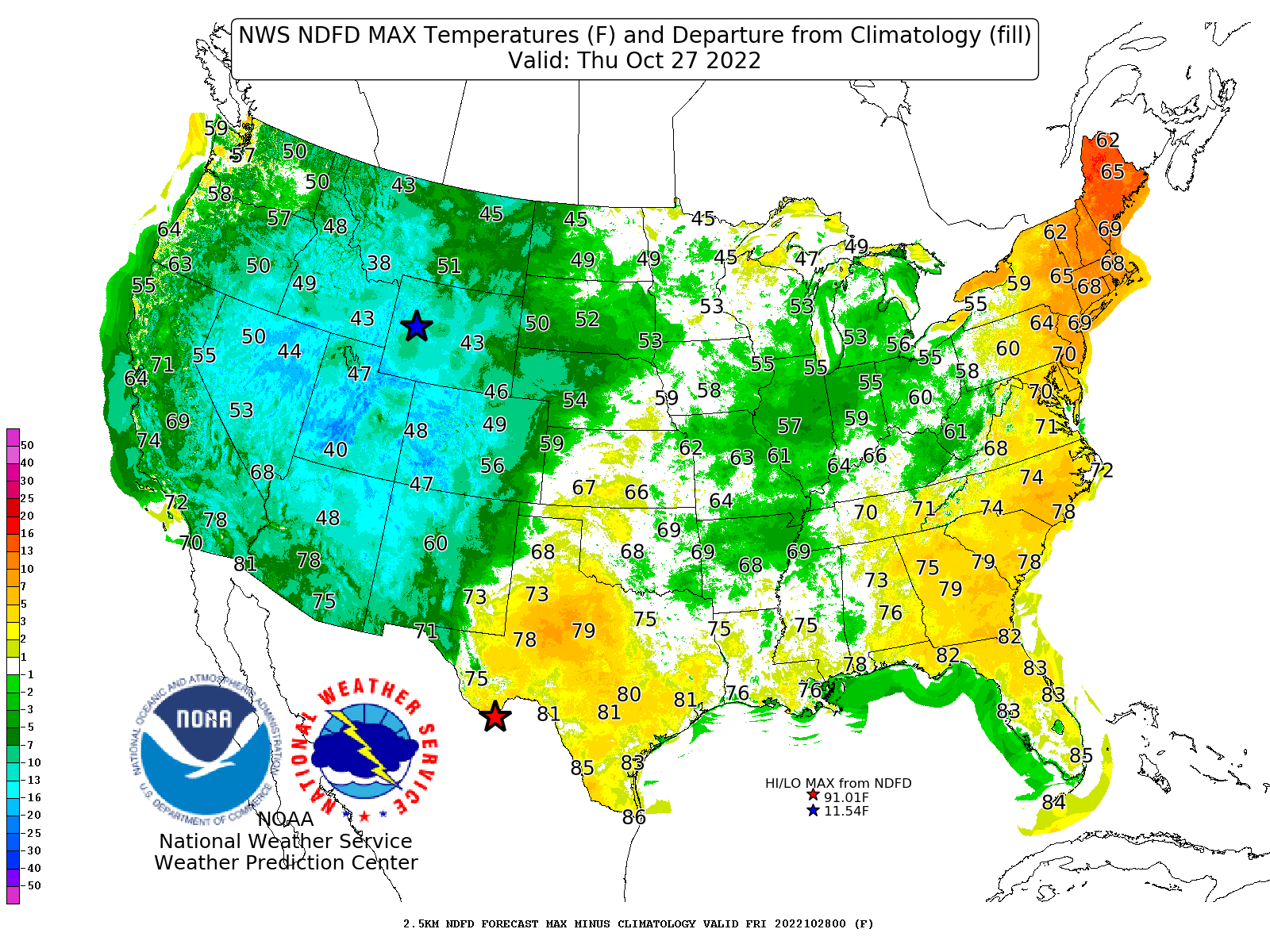
Projected high temperatures on Thursday, Oct. 27, 2022. Red/blue shading indicates above/below average temperatures.