

Weekly Weather Bites
Potent storm system incoming

By Matthew Holliday
Weather Bites
A potent, digging shortwave is bringing another significant winter storm to the Sierra Nevada and southern California mountains. Snow rates have reached 1 to 4 inches per hour already! Once the shortwave fully passes through the region on Wednesday, quieter weather will finally settle in for a bit.
The California shortwave will cross the Four Corners mid-week, bringing a multi-day severe weather risk to the Southern Plains, Mid-South, and Southeast on Wednesday through Friday. Unfortunately, nighttime tornadoes will pose a threat overnight Thursday across the Mid-South.
The same system will bring a 2-day heavy rain event this week across 1) Arkansas, 2) Tennessee, 3) the middle Mississippi River Valley, 4) the far upper Gulf coast states, and 5) the Ohio River Valley. Some areas could receive 3+ inches over a short period of time.
The Pacific Northwest and upper California will remain active through at least the weekend. Two shortwaves, one approaching the coast on Wednesday and another early weekend, will bring at least two rounds of heavy precipitation. The northern half of the Cascades will receive heavy snowfall with the first system, and most of the mountain range will get heavy snow from the weekend storm.
The same system bringing severe storms to the South will bring a powerful winter storm to the lower and eastern Great Lakes, New England, and northern Mid-Atlantic late week into the weekend. Snow totals could become quite hefty.

Projected 3-day rainfall totals: Tuesday evening through Friday evening
Interesting weather
We’ve been sharing Cali snow pics with our Facebook and Instagram followers. We’ve been mostly snow-starved in the eastern U.S. this winter. At least we can look at snowy pictures.
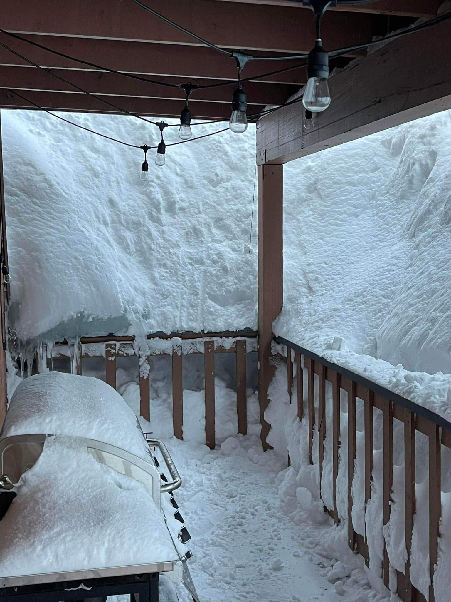
Shared by Carter Murphy in Mammoth Lakes, California.
The National Weather Service confirmed five tornadoes touched down in central Oklahoma on Sunday. They have rated the Norman, Oklahoma tornado an EF-2.
Winds were so strong in Duncan, Oklahoma that a sign impaled a wooden door.
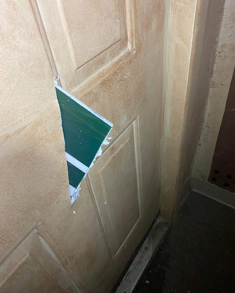
Shared by Keith Allen.
Long-range forecast discussion
The first ten days of March will mostly bring the same weather pattern most experienced this winter. The Southeast ridge will hang tight, bringing anomalous warmth most days across much of the eastern U.S., while the western third of the nation experiences well below-average temperatures. The Plains will sorta bounce back and forth between above and below-average temperatures.
But much of the eastern U.S. is experiencing a false spring. After about March 10th, a cooler pattern should emerge across much of the lower 48. Persistent troughing over the western U.S. has allowed southeastern ridging to become a semi-permanent feature this winter. It’s not uncharacteristic for us to see such a pattern configuration during La Niña winters, but the 2022-23 winter has been especially snow-free in much of the eastern U.S.
Unfortunately for snow lovers in the Southeast, the sustained cold will arrive a couple of weeks too late for wintry precipitation outside of the mountains. The cool pattern will likely be quite widespread across the lower 48, not focusing on any specific section of the U.S. Luckily for the Florida peninsula, which has experienced an exceptionally dry winter, they should manage to start getting rainfall at or a little above normal starting around mid-month.

Probability of above/below average temperatures March 11-24, 2023
Thank you for all that you do to keep us informed on the weather. Most trusted in my book.
Great info. Matthew. Thanks again.